Basic components of the physical enviroment. Landforms.
1. Landforms of Surface relief.
We can distinguish four basic relief forms on the continents and islands.
a).Plains, extensive áreas of flat or gently undulating land which are located at an altitude of less than 200 metres above sea level.

African plain.
b).Plateaus, elevated plains which are located at altitudes of more tan 200 metres above sea level.

Columbia Plateau.
c). Mountains. Elevated landforms which have an altitude of more tan 600 metres and very steep slopes. Can be:
-Old, then have rounded forms and are calle massifs.

-Young, with pointed forms.

K-2, Himalaya.
-Normally are grouped into large groups, called ranges or sierras.

d).Depressions: sunken áreas which correspond to sunken blocks of terrain.
Can be:
-Depressed areas between mountains or plateaus called valleys.
-Elongated depressions excavated by the rivers called river valleys.


2. Landforms below sea level.
We can distinguish several basic forms of the relief bellow the waters of the oceans:
• Continental shelf, a gente slope that extends from the continents beneath the sea waters.
• Continental slope: Sharp decline between the continental shelf and the abyssal plain.
• Continental margin, pronounced step which connect the continental shelf with the abyssal plain.
• Abyssal plain, huge extensións of flat terrain located between the continental shelfs with a depth of between 4. 000 and 5. 000 metres.
• Oceanic ridges, underwater mountains systems of several thousands metres of height.
• Oceanic trench, narrow elongated drepressions which cut the abyssal plains.

Diagram of surface landforms.
3. Coastal relief.
Coasts are areas of contact between the surface of the continents and the oceans and seas. Depending of their height can be: cliffs, raised terrain or , beaches, low-lying terrain.
We can distinguish the following forms of reliefs:
• Beaches: flat surfaces found along the sea shore, are formed by the acumulation of sediments.

• Cliffs: elevated areas with a very steep side located on a coast.

• Capes or headlands, areas where the coast juts into the sea or land surfaces that are partially surrounded by the sea.

• Gulfs, areas where the sea is partially enclosed by the Earth.

• Estuaries, river valleys which have been flooded by the sea.

• Fjord, a glacial valley which have been flooded by the sea.

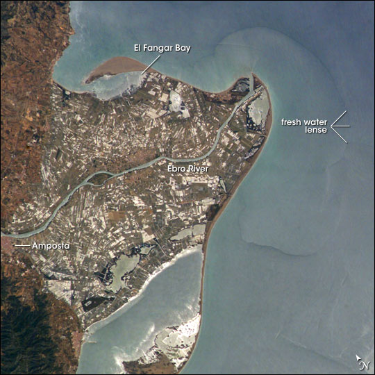
• Delta a coastal landform located at the mounth of a river, formed by the accumulation of sediments.

• Peninsula, extension of land surrounded by water on all sides except one.


- Ithsmus, is the extension of land which links the peninsula to the continent.

Diagram of the main coastal landforms.


The Earth’s relief is the combination of landforms which
appear in Earth’s surface.
We can distinguish two phases in the evolution of the
relief: formation and evolution. The formation and the evolution of the relief is the consequence of the action of a variety of internal and external forces:
-internal forces which explain the formation of the relief: orogenesis, earthquakes, volcanoes.
-external forces which explain the evolution of the relief: atmospheric elements, water and living beings.
2. Relief formation and its agents.
The relief is form by the earth’s internal forces which
raise, sink or move blocks of terrain. The main internal forces are:
• Orogenesis
is the process of forming mountains. It occurs in the area where two tectonic
plates come into contact.

• Earthquakes,
sudden movements of the Earth’s crust caused by the clash of two tectonic
plates.

• Volcanoes
are ruptures in Earth’s crust through which magma are released onto Earth’s
Surface. Are
located in áreas where two tectonic plates make contact.

3. Relief modification and its agents.
The modification of the relief is caused by the Earth’s
external forces which produces:
Erosion, the wearing down of types of relief.
Movement of the eroded materials.
Sedimentation, the acumulation of eroded materials in
specific areas.

The main Earth’s external forces are:
- Atmospherics elements, such as:
-Temperature, the rapid changes of temperature make the rocks
expand and contract.

-Rainfall penetrates the cracks in the rocks and expands when
freezes, breaking the rocks. Also transport the eroded materials.

-Wind erodes the rocks, breaking them down. Also transport the eroded materials.

- Water, disolves certains components of the rocks, excavating valleys and ravines. Also transport the eroded materials.

- Living beings. Vegetations and animals change the relief breaking the rocks.
Human beings also modifies the relief by mining or building motorways Root wedging
 The big Hole, Kimberley (Sout Africa):


The Earth’s water.
Hydrosphere (in spanish Hidrosfera) is the combination of all the waters to be found on Earth. It includes:
Marine waters (oceans and seas), represent about 97’5% of the Earth’s waters and covers about 70% of the Earth’s surface.
Continental waters, most of them are fresh waters and represent a 2’5% of the Earth’s waters. Includes rives, lakes, glaciers and aquifers.


Marine waters.
We can distinguish two types of marine waters:
Oceans (in spanish Océano) are large masses of salt water. There are five oceans in order of size are:the Pacific, the Atlantic, the Indian Ocean, the Arctic and the Antarctic.
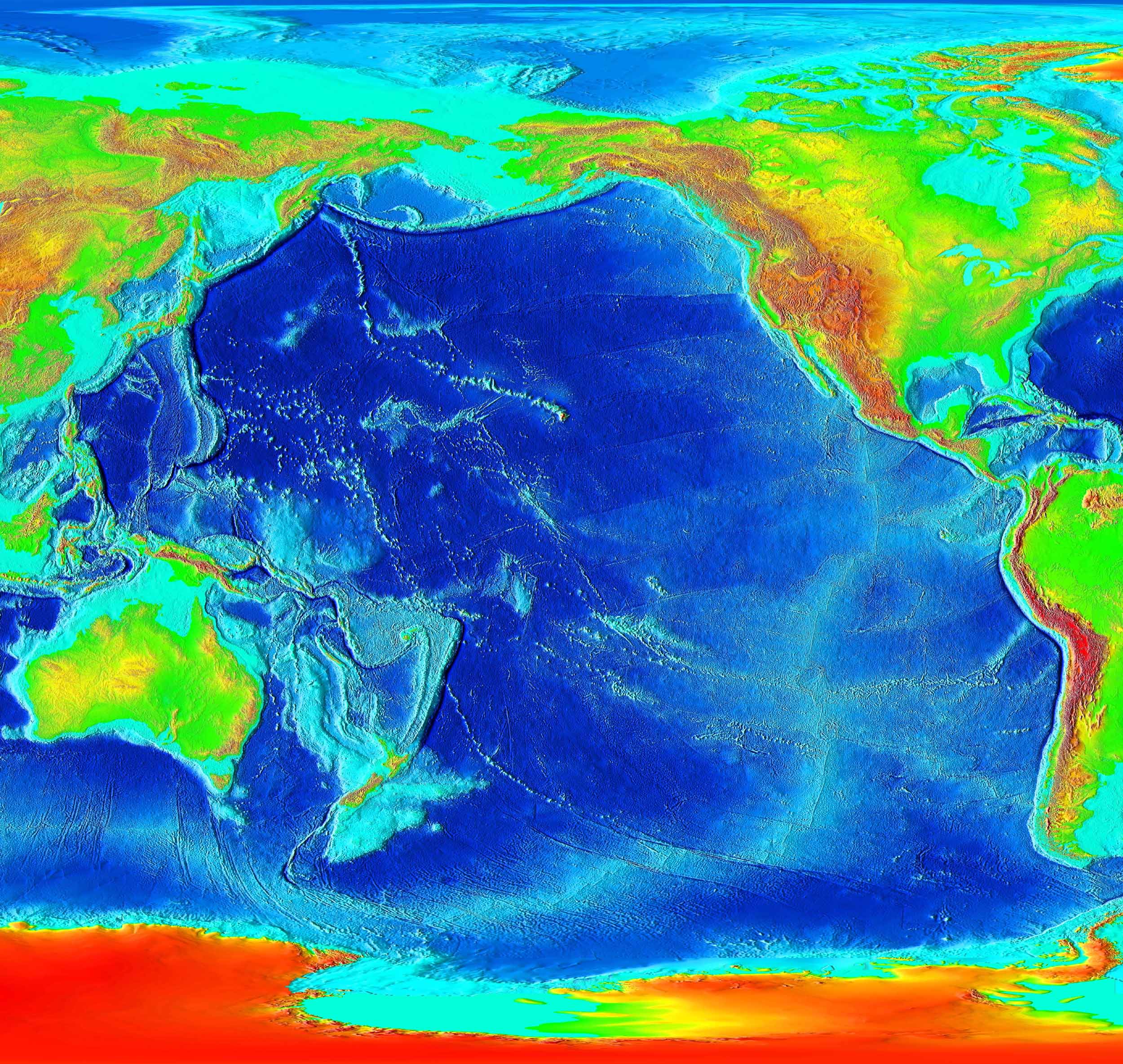 |
| Pacific Ocean, the largest ocean of Earth. |
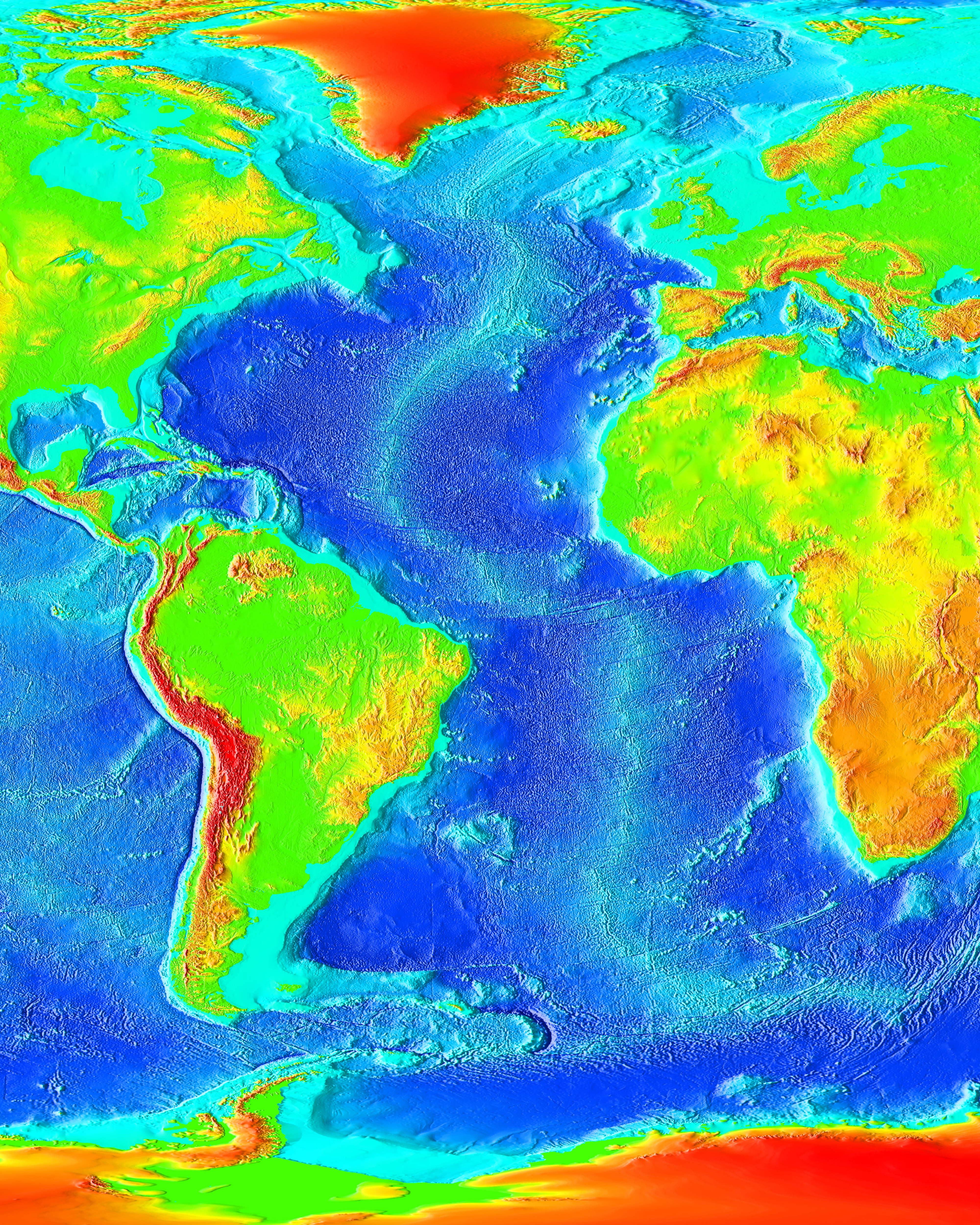 |
| The Atlantic Ocean. |
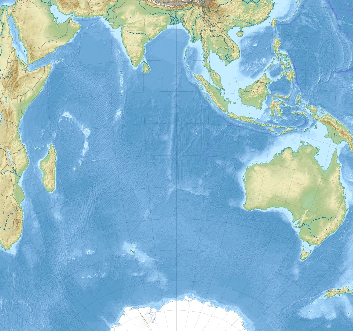 |
| The Indian Ocean. File:Indian Ocean laea relief location map.jpg https://commons.wikimedia.org/wiki/File:Indian_Ocean_laea_relief_location_map.jpg https://commons.wikimedia.org/wiki/User:Uwe_Dedering |
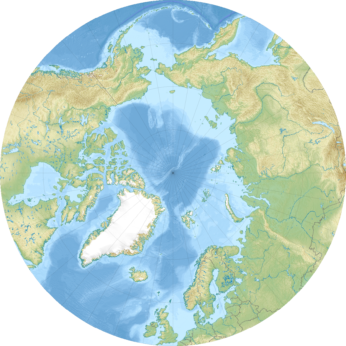 |
| The Artic Ocean. |
 |
| Antarctic Ocean. |
Seas, are áreas of the oceans that:
-Are close to the coastline.
-Shallower than the rest of the ocean.
For historical or cultural reason have their own names.


The water of the oceans has two main characteristics:
1.It is salt water, has sodium chloride disolved in it.
2.It is constantly moving. Has several kind of movements:
-waves (in spanish olas), the undulating movement on the sea’s surface caused by the wind.


-tides (in spanish mareas), the rise and fall of the sea level caused by the Moon.


-marine currents (in spanish corrientes marinas), movements of large masses of water through the oceans.

Are caused by two factors:

Are caused by two factors:
- The difference of temperature and salt levels of the oceanic waters.
- The wind.
- Warm and cold, depending on wheter the temperature of the water that flow through it is lower or higher than the temperature of the water surrounding it.
- Surface or deep-sea depending of its depth.
A message in a bottle found three years and 5.000 kilometres later.
Experiment about water temperature and salinity.
Experiment about water temperature and salinity.
Continental waters:
Most of the continental waters are fresh waters. Among them we can distinguish several types:
- Glaciers (in spanish glaciar), large acumulation of frozen water. Most of them are located in Greenland, the Antarctica and high mountains.Them have two main parts:
- Cirque (in spanish circo), a steep bowl-shaped depression which form the head of the glacier.
- Tongue (in spanish lengua), a narrow extension of ice projecting from the glacier cirque.

- Rivers are continuous currents of water that flow along a course. Most of them begin as springs (in spanish manantial) and are supplied by rainfall or melting snow. Can flow into the sea or another river. We can distinguish three parts in the course of a river:
- Upper course, the river flows in the mountains. Here flows very fast.
- Middle course, the river flows through flat lands. The speed of the current is slower and the current of the river bends, forming meanders. A meander, is a bend in the course of the river formed by the accumulation of sediments.
- Lower course, the river flows into the sea.
 |
| Upper course. |
 |
| Middle source. |
 |
| Lower course |
- Lakes (in spanish lago), are acumulations of water in low-lying areas of the Earth's crust. The water is supplied by rainfalls or rivers. We can also distinguish:
- Lagoons (in spanish laguna), small lakes.
- Seas (in spanish mares), huge lakes such as the Caspian Sea.
 |
| Caspian Sea, the largest lake in Earth. |
- Aquifers, are subterranean reserves of water, formed by the infiltration of water from the Earth's surface.

The water cycle.
The water cycle is the state of permanent circulation of the Earth's water. Water in Earth appears in the three states: liquid, solid (ice) and gaseous (water vapour).
The fundamental processes of this cycle are:
- Evaporation, the change of water from a liquid to a gas (water vapour). Solar energy causes the evaporation of the surface water of the oceans and continental waters (lakes, rivers, etc.).
- Condensation: Water vapour rises, cools, condenses and form clouds which are transported by the wind.
- Precipitation is the fall of the water onto the Earth’s surface in the form of rain, snow or hail. Is caused by the condensation of the water inside the clouds. When the clouds go up, water vapour cools and little drops of water appears. This drops combine with one another and when they reach a diameter of 0.5 mm fall to the ground.
- A part filters into the subsoil and forms aquifers (infiltration). Sometimes the water of the aquifers reaches the surface trough a spring.
 |
| Water spring. |
- Other remains on the surface forming rivers and lakes.
Finallly, the rivers and the aquifers run into the oceans and the cycle stars again.
The water cycle is a constant and balanced process. The total amount of evaporation and precipitation are compesated and as a consequence the quantity of water on the planet remains constant.
 |
| Water cycle. |
Water scarcity
ACTIVITIES:
1. Fill the blank spaces with the correct words:
The oceanic waters has three kind of movements: ______, _____ and ______ _______. A _____ is
a _________ movement of the sea's _______ caused by the ____.The ____ are the change of the
____ _____ caused by the ___________ pull of the ____. The _____ ______ are the ________ of
____ _____ caused by the ___________ pull of the ____. The _____ ______ are the ________ of
huge masses of _____ inside the oceans caused by the ____ and the differences of ________ and
_________ between the different parts of the oceanic waters.
2.Complete the diagram with the correct words.

2.Complete the diagram with the correct words.

Activity:
1. Write down the name of the landform next to the definition:
UNIT 1. THE RELIEF.
With an A
|
Huge extensións of flat terrain located between the continental shelfs with a depth of between 4. 000 and 5.
| |
Contains a B
|
Flat surfaces found along the sea shore, are formed by the acumulation of sediments.
| |
With a C
|
An area where the coast juts into the sea or land surfaces that are partially surrounded by the sea.
| |
With a C
|
Elevated areas with a very steep side located on a coast.
| |
With a C
|
The exterior layer of the Earth, is made up of solid rock.
| |
With a D
|
A coastal landform located at the mounth of a river, formed by the accumulation of sediments.
| |
With an E
|
Sudden movements of the Earth’s crust caused by the clash of two tectonic plates.
| |
Contains an F
|
A glacial valley which have been flooded by the sea.
| |
With a G
|
Areas where the sea is partially enclosed by the Earth
| |
With a E
|
River valleys which have been flooded by the sea.
| |
Contains an I
|
Is the extension of land which links the peninsula to the continent.
| |
With an L
|
A depression filled by water
| |
With a M
|
Elevated landforms which have an altitude of more tan
| |
With an M
|
Old mountains which have rounded forms.
| |
With an O
|
The process that explain the apparition of mountains. It occurs in the area where two tectonic plates come into contact.
| |
With a P
|
extension of land surrounded by water on all sides except one.
| |
With a P
|
Extensive áreas of flat or gently undulating land which are located at an altitude of less than
| |
With a P
|
Elevated plains which are located at altitudes of more tan
| |
With an R
|
Large group of mountains.
| |
With an R
|
Underwater mountains systems of several thousands metres of height.
| |
With a T
|
Narrow elongated drepressions which cut the abyssal plains
| |
With a T
|
Huge wave that appear as a consequence of a underwater earthquake.
| |
With a S
|
Sharp decline between the continental shelf and the abyssal plain.
| |
With a V
|
Sunken area of terrain located between mountains or plateaus
| |
With a V
|
ruptures in Earth’s crust through which magma are released onto Earth’s Surface
|
No hay comentarios:
Publicar un comentario